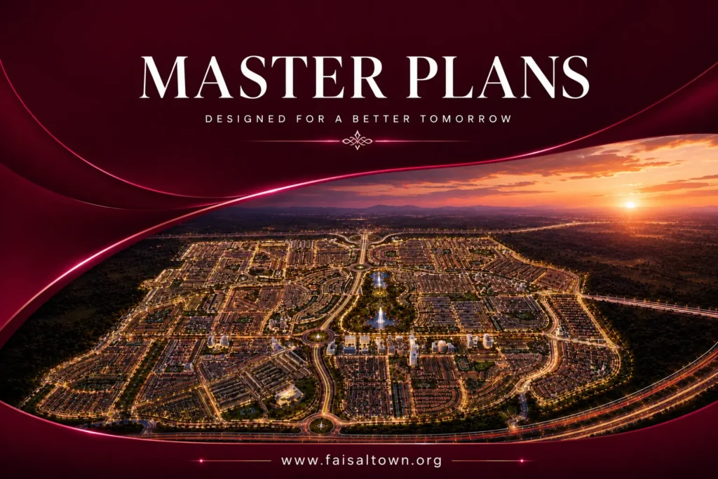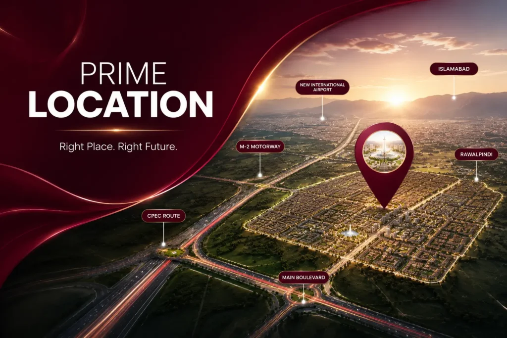


Whether you’re a local investor weighing options near the M-2 or an overseas Pakistani trying to picture exactly where your money’s going, Faisal Town Phase 2‘s location is always where the conversation starts. Fair enough, it’s the one thing that determines everything else: convenience, resale value, and how the whole area actually develops around you.
This guide covers where the project actually sits, how to reach it from a few different directions, what’s built up nearby, and why this particular stretch of the M-2 Motorway corridor keeps attracting new development.
Where Faisal Town Phase 2 Actually Sits
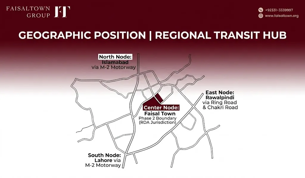
The project sits near Thalian Interchange on the M-2 Lahore-Islamabad Motorway, in Rawalpindi District, Punjab. That puts it outside Islamabad’s CDA boundary and under the Rawalpindi Development Authority (RDA)‘s jurisdiction instead, worth knowing since it tells you which office to actually call if you ever need to verify current Faisal Town Phase 2 NOC status.
The land runs along the M-2 on one side and toward the developing Rawalpindi Ring Road corridor on the other. People call it the “Faisal Town Phase 2 Islamabad location” a lot, even though it technically sits in Rawalpindi District, mostly because it’s close enough to the capital that nobody bothers with the distinction in everyday conversation.
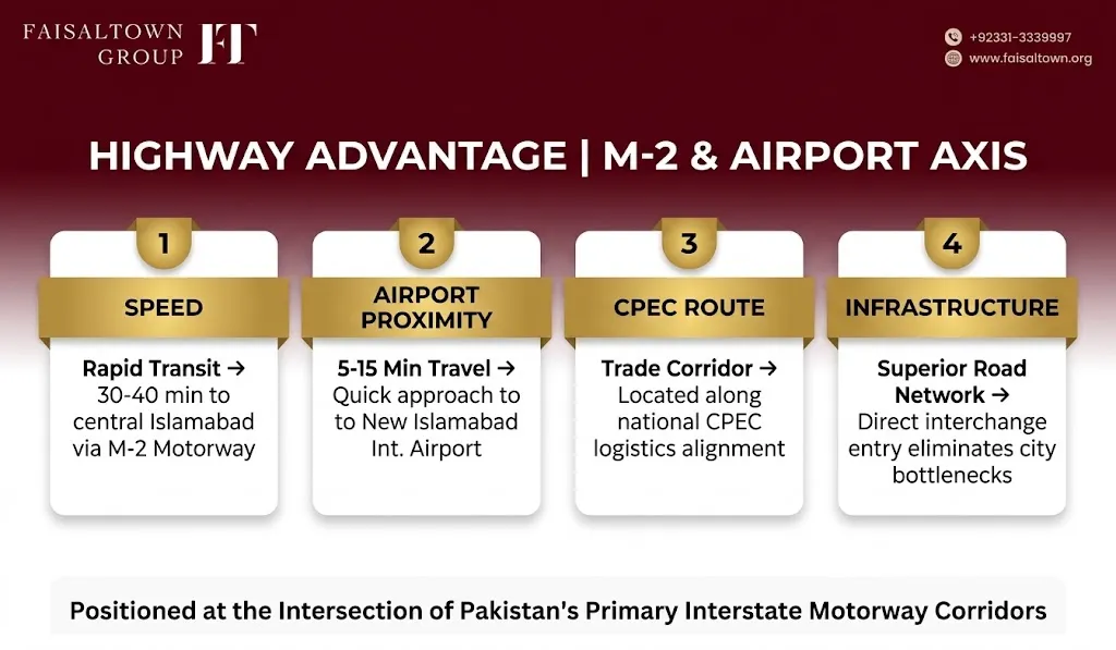
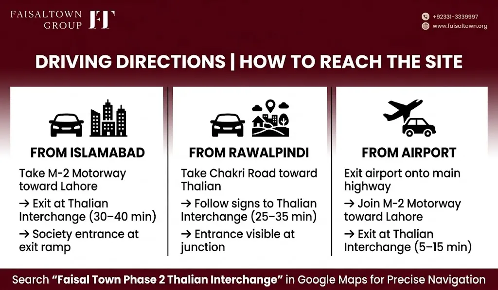
The simplest way to picture it: roughly 5 to 15 minutes from New Islamabad International Airport, 25 to 35 minutes from central Rawalpindi, and 30 to 40 minutes from central Islamabad via the motorway.
Getting There: Thalian Interchange and the Main Boulevard
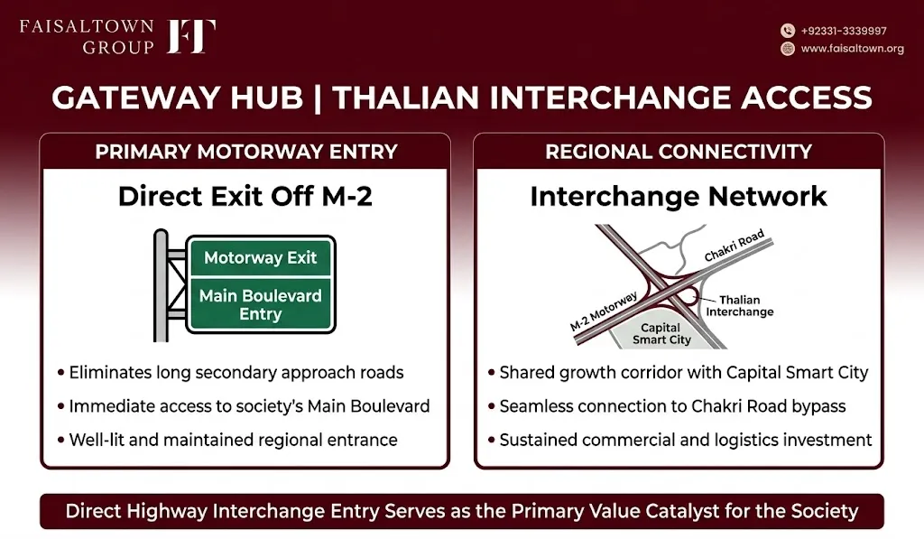
The project’s main entrance sits directly off Thalian Interchange, which is a genuine advantage compared to societies that make you navigate several kilometers of unfinished approach road before you even reach the gate. From the interchange, the main boulevard, reported at 350 to 365 feet wide depending on the section, runs straight into the project toward the Central Business District and the residential sectors beyond, as laid out on the current master plan.
Sectors closer to the entrance, like Sector O and the Overseas Enclave, tend to have the most developed infrastructure. The further out you go, the newer and less finished things generally get, which is typical for a project still building out sector by sector.
Why Sitting Right on the M-2 Actually Matters
The M-2 is Pakistan’s best inter-city motorway, doing the Lahore-Islamabad run in about 3.5 to 4 hours. Sitting right next to it, with its own dedicated interchange, actually earns the project a few real advantages, not just marketing talk:
- Faster travel to central Islamabad than older GT Road routes
- Better road quality, since motorway-adjacent areas tend to get maintained properly
- Stronger long-term appreciation, since land near motorway interchanges has historically outperformed land stuck on secondary roads
- CPEC corridor adjacency, since the M-2 forms part of the wider China-Pakistan Economic Corridor network, which tends to draw national-level infrastructure attention over time
None of that is an overnight payoff. But as more traffic runs through the M-2 and the Ring Road’s southern arc gets finished, the Thalian Interchange becomes a genuinely more valuable anchor point than it is today.
Travel Times From Islamabad, Rawalpindi, and the Airport
| Starting Point | Route | Approximate Time |
| Islamabad (Blue Area) | Via M-2 Motorway | 30-40 minutes |
| Islamabad | Via GT Road and Chakri Road | 45-60 minutes |
| New Islamabad International Airport | Via M-2 Motorway | 5-15 minutes |
| Rawalpindi city center (Saddar) | Via Chakri Road and Ring Road | 25-35 minutes |
| Rawalpindi outer areas (near Bahria Town) | Via Ring Road | 15-25 minutes |
| Rawalpindi Cantonment | Via M-2/Ring Road | 30-40 minutes |
The motorway route wins on speed every time, which is the main reason the project can reasonably claim to be within commuting distance of Islamabad despite technically sitting in Rawalpindi District.
Chakri Road: The Second Way In
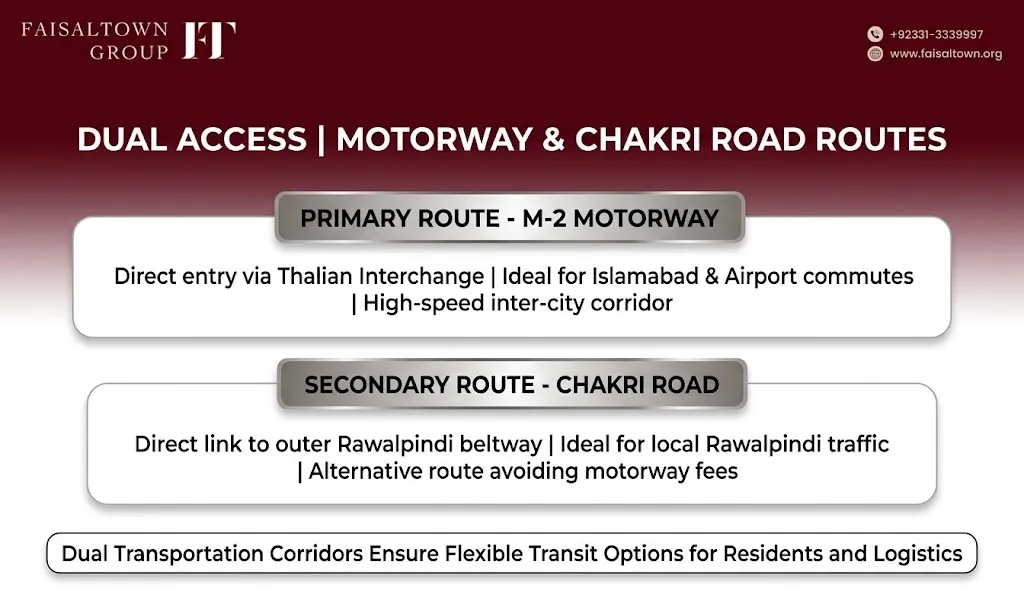
Beyond the motorway, Chakri Road offers a secondary approach that doesn’t require touching the M-2 at all, connecting to Rawalpindi’s outer ring and several nearby societies. For anyone who works in Rawalpindi rather than Islamabad, this route can actually be more practical for daily commuting than the motorway.
Chakri Road’s development is ongoing, and as it gets finished as part of the wider regional road plan, travel times between this area and Rawalpindi’s commercial centers should keep shrinking.
Directions to the Site From Three Starting Points
| From | Route | Approximate Time |
| Islamabad | M-2 toward Lahore, exit at Thalian Interchange, follow signage | 30-40 minutes |
| Rawalpindi | Chakri Road toward Thalian, continue to the interchange | 25-35 minutes |
| New Islamabad International Airport | Airport road, join M-2 toward Lahore, exit at Thalian | 5-15 minutes |
For navigation, searching “Faisal Town Phase 2 Thalian Interchange” on Google Maps is the most reliable way to land in the right area, since the project spans a large footprint rather than one exact pin.
Why the Airport Being Close Actually Matters
Proximity to New Islamabad International Airport is one of the most practically useful things about this location, not just a nice-to-have line in a brochure. For overseas Pakistanis flying in from the UK, UAE, Oman, Saudi Arabia, or Canada, landing and reaching the site in minutes makes an inspection visit realistic in a way it wouldn’t be for a site requiring a long cross-city drive. This is part of why our Overseas Enclave was positioned in one of the sectors closest to the entrance, keeping remote buyers’ site visits genuinely convenient.
As the airport keeps expanding capacity and adding routes, airport-adjacent land tends to hold up as one of the steadier long-term plays in the wider Islamabad property market.
The Rawalpindi Ring Road’s Future Impact
The Rawalpindi Ring Road, once complete, is meant to bypass the city center entirely, cutting congestion and improving access between Rawalpindi and its surrounding areas. For this project specifically, that means a more direct link into Rawalpindi without crossing city-center traffic, more interconnection with other societies along the Ring Road corridor, and new commercial activity that creates jobs nearby.
The Ring Road’s route runs close enough to this project that it’s genuinely one of the more directly affected beneficiaries once it’s finished, rather than just being generally in the same region.
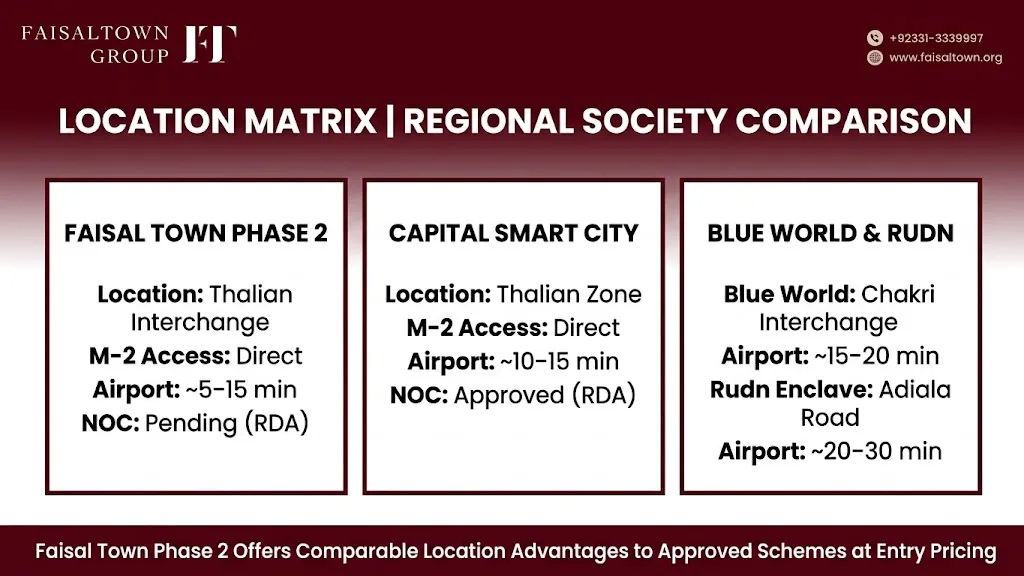
Faisal Town Phase 2 vs Nearby Societies
This stretch of the M-2 corridor has become genuinely crowded with competing projects, and understanding who else is here helps put this Faisal Town Phase 2 location in context.
| Society | Location | M-2 Access | Airport Distance | NOC Status |
| Faisal Town Phase 2 | Thalian Interchange | Direct | ~5-15 min | Pending (RDA) |
| Capital Smart City | Thalian zone, M-2 | Direct, same interchange | ~10-15 min | RDA Approved |
| Blue World City | Chakri Interchange, M-2 | Via Chakri Interchange | ~15-20 min | Under process |
| Rudn Enclave | Adiala Road | Via Chakri/Ring Road | ~20-30 min | Under process |
| Nova City Islamabad | M-2 corridor | Via Fateh Jang Road | ~15-25 min | Under process |
Faisal Town Phase 2 shares almost the same access setup as Capital Smart City, its most visible competitor in the area, but comes in at a lower entry price that reflects its earlier, pre-NOC stage. That’s really the core trade-off if you’re weighing this location against the neighbors: pay more for Capital Smart City’s regulatory certainty, or pay less here and accept more of the uncertainty that comes with a project still working through approval.
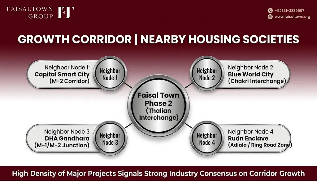
That so many developers have independently chosen to build in this exact corridor is itself a signal. Multiple companies looking at the same stretch of motorway and concluding it’s worth investing in isn’t a coincidence.
What’s Nearby: Schools, Hospitals, and Shopping
Beyond the project’s own boundary, a few things worth knowing about the surrounding area:
- Education: Roots International School operates campuses within the wider Faisal Town Group portfolio, and several established Rawalpindi schools are reachable within 20 to 40 minutes via Chakri Road. The project’s own plan includes an Education City zone for future schools and a university campus.
- Healthcare: Islamabad hospitals like Shifa International are accessible via the motorway, and Benazir Bhutto Hospital in Rawalpindi is reachable via the Ring Road. The master plan also sets aside space for healthcare facilities within the society itself.
- Commercial: Rawalpindi’s established shopping districts are a Chakri Road drive away, and the project’s own Central Business District is under development, eventually meant to offer in-society retail and office space.
Location Advantages Over Time
| Timeframe | What to Expect |
| 0-3 years | Lower entry price than established neighbors, room for upside once NOC clears, easy access to monitor construction |
| 3-7 years | Ring Road completion improves access and surrounding land values, airport expansion drives more commercial investment |
| 7+ years | CPEC corridor maturity anchors sustained investment, motorway-interchange land historically performs well long-term |
None of this is a guarantee, obviously, but it’s a reasonable way to think about how the location’s value might actually play out if the surrounding infrastructure delivers on schedule.
Frequently Asked Questions
Where exactly is Faisal Town Phase 2 located? Near Thalian Interchange on the M-2 Motorway, in Rawalpindi District, roughly 5 to 15 minutes from New Islamabad International Airport.
How do I get there from Islamabad? Take the M-2 toward Lahore and exit at Thalian Interchange, about 30 to 40 minutes depending on traffic. Chakri Road is a slower alternative.
How far is it from Rawalpindi? Roughly 25 to 35 minutes from central Rawalpindi via Chakri Road and Ring Road connections.
What’s the best way to find it on Google Maps? Search “Faisal Town Phase 2 Thalian Interchange” rather than just the project name, since it gives a more accurate area given how large the site is.
Which other societies are nearby? Capital Smart City, Blue World City, Rudn Enclave, and Nova City Islamabad all sit in the same general M-2 growth corridor.
Does the location make up for the pending NOC status? Location and regulatory approval are two separate things worth weighing independently. Verify current NOC status directly through the RDA’s own portal rather than assuming a strong location implies regulatory certainty. The location genuinely is strong, but that doesn’t change where the NOC currently stands, so factor both into your decision rather than letting one distract from the other.
Plan Your Site Visit
Faisal Town Phase 2’s location is, by most measures, one of the stronger arguments for this project long-term. Direct M-2 access via Thalian Interchange, real proximity to the airport, the Ring Road’s future impact, and a cluster of competing societies all betting on the same corridor aren’t coincidences, they reflect genuine market consensus about where this part of the twin cities is heading.
That doesn’t erase the project’s pending NOC status, which is still the bigger variable to track. Use Thalian Interchange as your navigation anchor, confirm the location on Google Maps before you travel, and bring your questions about NOC status along with you when you visit.
Call +92 331 333 9997 or email info@faisaltown.org to arrange a site visit or confirm current directions before you travel.