
A map is the starting point for any serious property decision, and the Faisal Town Islamabad map tells a more layered story than a single pinned location. Faisal Town Islamabad encompasses two distinct but related projects Phase 1 near Fateh Jang Road and the M-1 Motorway, and Faisal Town Phase 2 near Thalian Interchange on the M-2 Motorway both developed by the Faisal Town Group under Chaudhry Abdul Majeed but positioned at different points in the twin cities’ expanding geography.
This complete Faisal Town Islamabad map guide walks through both projects: their precise geographical locations, Faisal Town Islamabad location map reference points, connectivity routes, layout plans, block and sector maps, nearby landmarks, accessibility analysis, and what each location means for buyers and investors evaluating their property options in 2026.
1. Understanding the Faisal Town Islamabad Map: Two Projects, One Brand
The Faisal Town Islamabad map requires a clear starting framework: “Faisal Town Islamabad” is not one pinned location on a map it’s a brand umbrella covering two distinct developments at different geographical locations, united by the same developer group and the same quality ambitions.
Faisal Town Phase 1 (established): Located along the Fateh Jang Road (N-80 highway) near Tarnol Interchange, Rawalpindi. This is the original Faisal Town housing society — substantially built out, operational, and accessible from the M-1 Motorway.
Faisal Town Phase 2 (developing): Located near Thalian Interchange on the M-2 Lahore-Islamabad Motorway. This is the developer’s major expansion a large-scale township spanning approximately 80,000 to 100,000 kanals.
Anyone reviewing a Faisal Town Islamabad location map and expecting a single location will quickly find two distinct zones, each with its own layout, access routes, and stage of development. This guide covers both in the detail each deserves.
2. Faisal Town Phase 1 Map: Geographical Location and Reference Points
The Faisal Town Phase 1 map anchors the original society near these reference points:
- Primary address: Faisal Town, Fateh Jang Road (N-80), near Tarnol Interchange, Islamabad
- District: Islamabad Capital Territory / Rawalpindi border zone
- Developer head office: Faisal Tower, Main Fateh Jang Road, near Tarnol Interchange, Rawalpindi
Faisal Town Islamabad geographical location for Phase 1 places it:
- West of central Islamabad, along the Islamabad-Peshawar highway axis
- South of Margalla Hills
- Approximately 25–30 km from Islamabad’s commercial center (F-7, Blue Area)
- Within Rawalpindi District’s administrative boundary near the Islamabad border
Looking at the Faisal Town Islamabad housing society map for Phase 1, the society is bounded by Fateh Jang Road on one edge, with internal blocks arranged around a central commercial area and distributed residential sectors.
3. Faisal Town Phase 1 Accessibility Map: How to Get There
The Faisal Town Islamabad accessibility map for Phase 1 shows several approach routes:
From Islamabad (primary route):
- Take the Islamabad-Peshawar Highway (N-5) or the Grand Trunk Road toward Peshawar
- Connect to Fateh Jang Road (N-80)
- Follow signage toward Faisal Town — the society’s main gate is visible from the main road
From Rawalpindi:
- Take the Ring Road or Chakri Road network toward Tarnol
- Join Fateh Jang Road and follow toward Faisal Town
Via GT Road:
- GT Road provides an alternate surface route connecting from central Rawalpindi toward this zone
- Travel time approximately 30–40 minutes from central Rawalpindi in normal traffic
The Faisal Town Islamabad directions for Phase 1 are generally straightforward, since the society sits along an established, well-marked highway corridor rather than requiring navigation through multiple undeveloped approach roads.
4. Access from M-1 Motorway: Phase 1 Connectivity
Faisal Town Islamabad access from M-1 Motorway is a significant connectivity advantage for Phase 1 residents. The M-1 Motorway — connecting Islamabad to Peshawar — has an interchange near Tarnol that provides high-speed access:
- The Tarnol Interchange on M-1 is within close proximity to Phase 1’s main entrance
- Residents commuting toward Peshawar, Nowshera, or Attock can access M-1 within minutes of leaving the society gate
- Islamabad’s outer commercial zones (G-11 Markaz area) are accessible via M-1 without entering the city center’s traffic
This Faisal Town Islamabad road network connection to Pakistan’s motorway system is a meaningful quality-of-life advantage compared to societies without direct motorway access.
5. Access from Kashmir Highway: Faisal Heights and Phase 1 Block C
A specific Faisal Town Islamabad access from Kashmir Highway connection exists through Faisal Heights — the developer’s high-rise apartment project located in Block C of Faisal Town Phase 1, directly on Main Srinagar Highway (also called Kashmir Highway).
The Srinagar Highway / Kashmir Highway is one of Islamabad’s most important signal-free arteries, running from the G-11 Murree Road junction toward the airport and connecting to M-2 via the CPEC-linked highway network. Its significance for the Faisal Town Islamabad map is that:
- Faisal Heights (Block C, Phase 1) sits directly on this highway
- Commuters using the Srinagar Highway can access the Faisal Town Phase 1 vicinity without using internal roads
- The highway provides quick access to New Islamabad International Airport approximately 5–10 minutes away in normal traffic
6. Faisal Town Phase 1 Layout Plan and Block Map
The Faisal Town Islamabad layout plan for Phase 1 reflects a mature, substantially completed society rather than a developing one. The Faisal Town Phase 1 map shows:
Residential sectors: Multiple residential blocks with established infrastructure, numbered streets, and functional road networks. Most blocks are connected by paved internal roads with working utilities.
Commercial strip: A main commercial area running along the society’s primary internal road, hosting banks, pharmacies, restaurants, grocery outlets, and retail shops.
Faisal Heights Block C: Located on Srinagar Highway — a distinct vertical development within the Phase 1 boundary offering high-rise apartments rather than horizontal plots.
The Faisal Town Islamabad plots map for Phase 1 is primarily a resale market map rather than a developer booking map, since the society is largely developed. Buyers looking for plots in Phase 1 navigate the resale market through dealers and digital property portals.
7. Faisal Town Phase 2 Map: Geographical Location
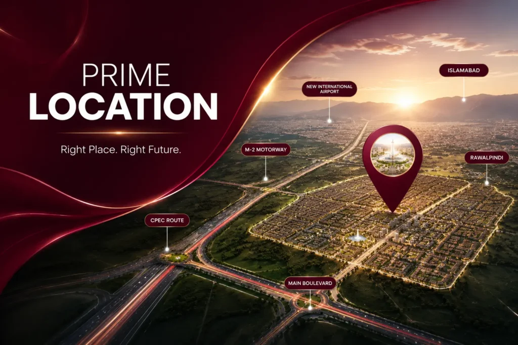
The Faisal Town Phase 2 map introduces a different geographical zone entirely — one that represents the developer’s most ambitious current project. Looking at the Faisal Town Islamabad location map for Phase 2:
- Primary anchor: Thalian Interchange, M-2 Lahore-Islamabad Motorway, Rawalpindi District
- District: Rawalpindi District (Punjab Province)
- Approximate location: Approximately 50 km west of central Islamabad by road, significantly closer via the M-2 Motorway
Faisal Town Phase 2 location details:
- The project’s main entrance is positioned directly off the Thalian Interchange
- The M-2 Motorway runs along the project’s primary access edge
- The Rawalpindi Ring Road (under construction) will provide a secondary connection to the east
- Chakri Road provides an alternate approach from the Rawalpindi direction
Looking at the Faisal Town Islamabad project map, Phase 2 sits in the cluster of major developments that have gathered at the M-2 corridor’s Thalian-Chakri zone, alongside Capital Smart City, Blue World City, and DHA Gandhara.
8. Faisal Town Phase 2 Near Thalian Interchange: The Core Access Point
Faisal Town Phase 2 near Thalian Interchange is the defining location statement for this project. The Thalian Interchange is:
- The M-2 Motorway exit and entry point that serves as Phase 2’s gateway
- One of the highest-traffic interchange points on the M-2, shared with Capital Smart City
- Directly connected to the M-2’s full Lahore-Islamabad length, enabling city-to-city travel at motorway speeds
- The same interchange from which the project’s 350–365 feet Main Boulevard originates
The Faisal Town Phase 2 map shows the society spreading outward from this interchange in multiple directions, with the main entrance facing Thalian Road and the site extending into surrounding land areas. Sectors positioned closest to the interchange, such as Sector O and the Overseas Block, benefit from the strongest proximity advantage.
On the Faisal Town Islamabad accessibility map, the Thalian Interchange position rates as one of the strongest access configurations among privately developed housing societies in Pakistan — direct motorway access within meters of the society gate.
9. Faisal Town Phase 2 Near Rawalpindi Ring Road: Future Connectivity
Faisal Town Phase 2 near Rawalpindi Ring Road describes a future connectivity upgrade that will materially change the Faisal Town Phase 2 route map when completed.
The Rawalpindi Ring Road is a major infrastructure project designed to create a peripheral bypass around Rawalpindi, connecting its outer zones and reducing congestion on internal city roads. When completed:
- It will provide a direct link between Faisal Town Phase 2‘s location and multiple Rawalpindi entry points without requiring motorway use
- Travel time from Faisal Town Phase 2 to central Rawalpindi commercial areas will reduce significantly
- Several housing societies along the Ring Road corridor will become more interconnected, increasing the overall residential population density that benefits everyone in the surrounding zone
The Faisal Town Phase 2 development map in future years will show this Ring Road as a second major access artery alongside the M-2 Motorway, strengthening what is already a well-connected location.
10. Faisal Town Phase 2 Location Map: Route Options
The Faisal Town Phase 2 location map reveals three distinct route options for reaching the site:
Route 1: Via M-2 Motorway (Primary)
- Join M-2 from Islamabad’s outer ring
- Travel toward Lahore on the M-2
- Exit at Thalian Interchange
- The society entrance is directly accessible from the interchange
Suitable for: Residents coming from Islamabad, airport commuters, Lahore-bound travelers
Route 2: Via Chakri Road (Secondary)
- From Rawalpindi’s western areas, take Chakri Road toward Thalian
- Continue toward Thalian Interchange
- Society entrance accessible from the interchange area
Suitable for: Rawalpindi-based residents who prefer avoiding motorway tolls
Route 3: Via Rawalpindi Ring Road (Future)
- When complete, will connect Faisal Town Phase 2 directly to Rawalpindi’s peripheral road network
- Will provide a high-standard alternative to current Chakri Road access
Faisal Town Islamabad connectivity routes via these three options give residents meaningful flexibility in daily commuting, which is an underappreciated quality-of-life factor in a region where many commuters are dependent on single-access roads.
11. Faisal Town Phase 2 Master Plan Map and Layout Overview
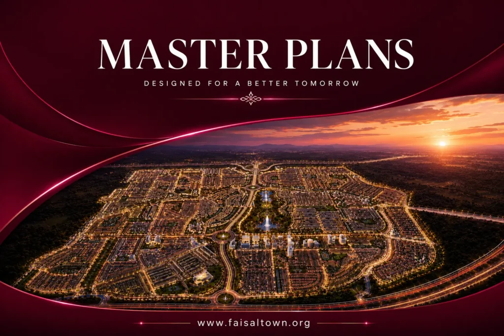
The Faisal Town Islamabad master plan map for Phase 2 is significantly more complex than Phase 1, reflecting the project’s much larger scale. The Faisal Town Phase 2 master plan map organizes the project as follows:
Spatial hierarchy:
- Main Boulevard (350–365 ft) as the primary spine
- Secondary collector roads branching from the boulevard into sectors
- Tertiary residential streets within each sector
Zoning on the map:
- Residential sectors: A through X (alphabetically labeled)
- Overseas Block / Overseas Enclave (named, near entrance)
- Sector O (Model Block — named, adjacent to CBD)
- N Block (named, launched late 2025)
- Central Business District (at the heart of the master plan)
- Commercial Districts East and West (flanking the CBD)
- Education City (dedicated institutional zone)
- Sports City (dedicated recreation zone)
The Faisal Town Islamabad layout plan places the CBD approximately at the geographic center of the project, equidistant from entrance and outer sectors, with residential blocks radiating outward in all directions from this commercial nucleus.
12. Faisal Town Phase 2 Plots Map and Block Map
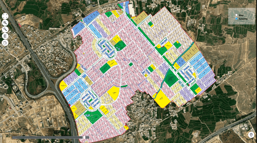
The Faisal Town Phase 2 plots map gives investors the information needed to understand which plots sit where relative to key landmarks:
Most valuable locations on the plots map:
- Main boulevard-facing plots (commercial or residential near main road)
- Plots in Sector O nearest to the CBD and Commercial District East
- Corner plots within any sector (15% premium)
- Park-facing or green belt-adjacent plots (5% premium)
- First-row plots on secondary roads immediately behind the Main Boulevard
The Faisal Town Phase 2 block map for residential sectors shows each block’s internal arrangement: street names or numbers (using alphanumeric labeling), plot boundaries, green belt allocations, sector markaz positions, and mosque locations.
The Faisal Town Islamabad block map for Phase 1, by contrast, is largely a historical record of what was planned and built over the past decade, updated primarily for resale market reference rather than new booking guidance.
13. Faisal Town Islamabad Development Map: Progress Across Both Phases
The Faisal Town Islamabad development map in 2026 presents two very different pictures:
Phase 1 development map:
- Substantially complete across most residential blocks
- Commercial strip fully operational
- Road networks functional throughout
- Faisal Heights (Block C) under construction post-August 2025 launch
Faisal Town Phase 2 development map:
- Sector O: ~80% developed — carpeted roads, demarcated plots, active villa construction
- Overseas Block: Active infrastructure progress near main entrance
- N Block: Early development stage following late 2025 launch
- Main Boulevard: Under active construction
- Sectors P–T and others: Various stages from initial groundwork to partial road completion
- CBD and commercial zones: Infrastructure preparation underway
The Faisal Town Islamabad latest map 2026 shows Phase 2 in an active growth phase, with real physical change visible at each site visit interval — a positive signal for investors who track construction pace as an indicator of project momentum.
14. Nearby Landmarks and Locations for Both Phases
Faisal Town Islamabad nearby landmarks and nearby locations differ between the two phases:
Phase 1 Nearby Locations:
- Tarnol Town: Immediately adjacent commercial and residential area
- Islamabad-Peshawar Highway: Running along the boundary
- Wah Cantt: Approximately 10–15 km along Fateh Jang Road
- GT Road: Accessible within 10–15 minutes
- Rawalpindi Cantonment: Approximately 25–30 km via highway
Faisal Town Phase 2 Nearby Locations:
- Capital Smart City: Sharing the same Thalian Interchange zone
- Blue World City: Approximately 5–10 km via Chakri Road
- DHA Gandhara: Accessible via M-1/M-2 junction
- Nova City Islamabad: Along Fateh Jang Road corridor
- New Islamabad International Airport: 5–15 minutes via M-2
- Thalian Town: Nearest urban settlement
These Faisal Town Islamabad nearby locations form the competitive and complementary ecosystem in which each phase operates — Phase 1 surrounded by established twin-cities residential and commercial zones, Phase 2 embedded within Pakistan’s most actively developing new housing corridor.
15. Distance from Islamabad International Airport
Faisal Town Islamabad distance from airport varies significantly between the two phases:
Faisal Town Phase 1:
- Airport distance: Approximately 20–30 minutes via Srinagar Highway/Kashmir Highway
- Route: From Tarnol/Fateh Jang Road, connect via ring routes to Srinagar Highway
Faisal Town Phase 2 near Islamabad International Airport:
- Airport distance: Approximately 5–15 minutes via M-2 Motorway
- Route: Exit M-2 at Thalian Interchange; airport accessed directly via M-2 in the opposite direction
This Faisal Town Islamabad distance from airport comparison gives Phase 2 a clear edge for buyers prioritizing airport proximity — a factor that’s increasingly relevant given Islamabad airport’s growing traffic and its status as Pakistan’s primary international gateway.
The best housing societies near Islamabad Airport conversation frequently places Faisal Town Phase 2 among the top options specifically because of this 5–15 minute drive time.
16. Faisal Town Islamabad Road Network and Connectivity Routes
The full Faisal Town Islamabad road network connecting both phases includes:
National highways:
- M-1 Motorway (Islamabad-Peshawar): Directly accessible from Phase 1 via Tarnol Interchange
- M-2 Motorway (Lahore-Islamabad): Directly accessible from Phase 2 via Thalian Interchange
- N-80 (Fateh Jang Road): Primary surface road serving Phase 1
Regional roads:
- Chakri Road: Phase 2 secondary access toward Rawalpindi
- GT Road: Phase 1 regional connectivity
- Rawalpindi Ring Road (under construction): Future Phase 2 connectivity improvement
Urban connectivity:
- Srinagar Highway / Kashmir Highway: Phase 1 Block C (Faisal Heights) direct frontage; airport connectivity
- Islamabad Expressway: Accessible from both phases via connecting road network
17. Faisal Town Islamabad Sectors and Blocks: Navigation Guide
Navigating the Faisal Town Islamabad sectors and blocks across both phases requires understanding each project’s internal geography:
Phase 1 Block Navigation:
Phase 1 is organized into lettered blocks (Block A, B, C, etc.) within the established residential area, supplemented by a commercial strip. Block C specifically is the Phase 1 area along Srinagar Highway where Faisal Heights is located. Navigation within Phase 1 uses a conventional street numbering system that long-term residents and local dealers know well.
Phase 2 Sector Navigation:
Faisal Town Phase 2 uses an alphabetical sector system (Sectors A through X) supplemented by named blocks:
- Overseas Block: Near main entrance off Thalian Interchange
- Sector O: Adjacent to Commercial District East, near CBD
- N Block: Near CBD and Sector O
- General Block: Budget residential option
- Sectors P, Q, R, S, T: Near commercial core
For any buyer trying to locate their specific plot on the Faisal Town Phase 2 block map, the most useful navigation reference is the distance from the Main Boulevard and the specific sector letter, which determines distance from the entrance and associated price tier.
18. Investment Location Comparison: Phase 1 vs Phase 2
From a Faisal Town Islamabad investment location perspective, the two phases serve different investment strategies:
| Location Factor | Phase 1 | Faisal Town Phase 2 |
| Airport distance | 20–30 min | 5–15 min |
| Motorway access | M-1 (Tarnol) | M-2 (Thalian) |
| Development stage | Substantially complete | Mixed (Sector O ~80%) |
| Entry price (5 Marla) | PKR 12M–22M (houses, resale) | PKR 2.78M–3.5M (plots) |
| Growth potential | Moderate (mature market) | Higher (emerging market) |
| Legal status | NOC approved | NOC pending (RDA) |
| Rental market | Active | Developing |
| Infrastructure | Fully operational | Under development |
The Islamabad real estate location guide analysis here shows Phase 1 as the lower-risk, lower-growth option and Faisal Town Phase 2 as the higher-growth, higher-risk alternative — consistent with the broader pattern across Pakistan’s housing market where pre-approval investments at lower entry prices carry corresponding regulatory uncertainty.
19. Best Housing Societies Near Islamabad Airport: Comparison Table
| Society | Airport Distance | Motorway Access | NOC Status | 5 Marla Plot Price |
| Faisal Town Phase 2 | 5–15 min | M-2 (Thalian) | Pending (RDA) | PKR 2.78M–3.5M |
| Capital Smart City | 10–15 min | M-2 (Thalian) | RDA Approved | Higher |
| Blue World City | 15–20 min | M-2 (Chakri) | Under Process | Varies |
| DHA Gandhara | 10–15 min | M-1/M-2 | DHA Approved | Premium |
| Top City-1 | 5–10 min | N-80 adjacent | Approved | PKR 3M–5.5M |
| Faisal Town Phase 1 | 20–30 min | M-1 (Tarnol) | Approved | PKR 12M–22M (houses) |
Faisal Town Phase 2 holds its position among the best housing societies near Islamabad Airport on the strength of its airport proximity and lowest entry price — with the trade-off of a pending NOC relative to Capital Smart City and DHA Gandhara.
Conclusion
The Faisal Town Islamabad map tells the story of a developer group that has strategically positioned its projects across two of the twin cities’ most important connectivity corridors. Phase 1 along the M-1 Motorway represents the established chapter — a functional, built-out community with mature infrastructure and a well-understood location. Faisal Town Phase 2 near Thalian Interchange on the M-2 Motorway represents the current and future chapter — a large-scale developing project with direct airport access, motorway connectivity, and the lowest entry prices among comparable societies in the same corridor.
Understanding the Faisal Town Islamabad map in both its dimensions — Phase 1’s settled geography and Phase 2’s dynamic location — gives buyers and investors the context to make genuinely informed decisions. Whether your priority is a built community with legal certainty or an emerging motorway-adjacent project with growth upside, knowing where each sits on the map is the essential first step.
Call to Action
Ready to navigate the Faisal Town Islamabad map for yourself? Use Thalian Interchange as your navigation anchor for Phase 2, request the current block map and plots map from an authorized representative, and verify the latest Faisal Town Islamabad development map status with a physical site visit to Sector O. If this guide helped clarify the geography and connectivity picture for both phases, share it with anyone else researching property in the Faisal Town ecosystem.